
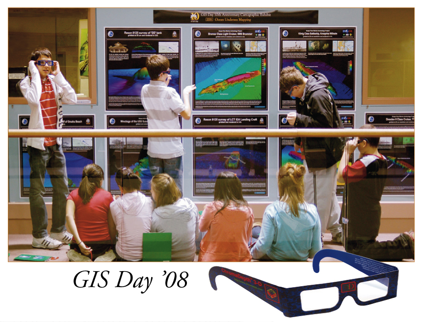
A Decade of GIS Days
THIS YEAR MARKED THE 10th ANNIVERSARY of the Geo-Information Science (GIS) Day Conference and College Fair, and ten years of effort by Michael Routhier of the Complex Systems Research Center. Routhier, who organizes the event each year, was lauded for the work he has done to bring GIS Day from its beginnings as a small, one-floor poster session to a professional venue.
“Among other things, GIS Day provides a unique opportunity for high school students to learn about the geospatial sciences and the technology, and it’s also an opportunity for them to see what research is going on at the university,” Routhier says.
GIS Day is focused on educating professionals, students and the public about geo-spatial science technologies—such as computerized mapping and remote sensing of the Earth’s surface with satellite imagery—and promoting career and educational opportunities within the field.
Routhier notes that among this year’s 650 attendees were more than 200 students from high schools around New England. There was even one student from New York State whose mother drove five hours to and fro to allow her son to take advantage of the unique daylong event.
From humble beginnings GIS Day has grown to the point where it can attract collaborators like NASA, the National Oceanic and Atmospheric Administration, the National Geographic Society, the Library of Congress and others.
For example, Routhier says, keynote speakers have included NASA astronaut Jay Apt, the senior cartographer of the U.S. National Park Service Tom Patterson, and the National Geographic Society’s chief cartographer Allen Carroll. Major exhibits through the years have included 90 years of mapmaking at the National Geographic Society, an ocean mapping and exploration cartographic exhibition from NOAA, and historic New Hampshire maps from the Library of Congress.
Although Routhier received special recognition for his efforts, he notes that it requires a great deal of work and expertise on the part of many EOS and university volunteer staff to successfully execute GIS Day. Likewise, he says, major funding provided by NASA’s New Hampshire Space Grant Consortium from the very beginning has fueled the event’s success.
“Among other things, GIS Day provides a unique opportunity for high school students to learn about the geospatial sciences and the technology, and it’s also an opportunity for them to see what research is going on at the university,” Routhier says.
GIS Day is focused on educating professionals, students and the public about geo-spatial science technologies—such as computerized mapping and remote sensing of the Earth’s surface with satellite imagery—and promoting career and educational opportunities within the field.
 |
GIS Day '08
Photo: Kristi Donahue, UNH-EOS |
From humble beginnings GIS Day has grown to the point where it can attract collaborators like NASA, the National Oceanic and Atmospheric Administration, the National Geographic Society, the Library of Congress and others.
For example, Routhier says, keynote speakers have included NASA astronaut Jay Apt, the senior cartographer of the U.S. National Park Service Tom Patterson, and the National Geographic Society’s chief cartographer Allen Carroll. Major exhibits through the years have included 90 years of mapmaking at the National Geographic Society, an ocean mapping and exploration cartographic exhibition from NOAA, and historic New Hampshire maps from the Library of Congress.
Although Routhier received special recognition for his efforts, he notes that it requires a great deal of work and expertise on the part of many EOS and university volunteer staff to successfully execute GIS Day. Likewise, he says, major funding provided by NASA’s New Hampshire Space Grant Consortium from the very beginning has fueled the event’s success.
by David Sims, Science Writer, Institute for the Study of Earth, Oceans, and Space. Published in Fall 2008 issue of EOS .