Research Sites
| |
| Current Sites |
| |
|
Thompson Farm Observatory
is located in Durham NH approximately two miles south of the University of New Hampshire (43.1078N, 70.9517W, elevation 131ft). This observatory contains both field and forested research facilities among 204 acres of mixed forest, fields, streams and wetlands within the Lamprey river watershed. This facility is suitable for research and educational opportunities in the terrestrial, atmospheric, and biological sciences as well as green energy technology.
Data available... |
|
Appledore Island Observatory
is located on Appledore Island home to the Shoals Marine Laboratory (SML). This 95 acre island is located 7 miles off the coast of Maine and New Hampshire in the Gulf of Maine amongst the Isle of Shoals (42.97N, 70.62W, 60 feet amsl). The observatory is powered by a solar and wind powered green energy system year round. Air quality measurements have been performed at the top of a 60 foot tower. The facility is suitable for research and educational opportunities in marine, atmospheric, and biological sciences, as well as green energy technology.
Data available... |
| |
| Historic Sites with Data Available |
| |
 |
| Castle Springs |
|
Castle Springs Observatory
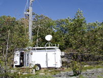
was located in Moultonborough, NH (43.75N, 71.35W, elevation 1300 ft). The observatory was on the Lakes Region Conservation Trust's Castle in the Clouds Conservation Area. The site was located on the southwestern flank of the Ossipee Mountains overlooking Lake Winnipesaukee on a rock outcrop surrounded by a hard wood dominated forest.
Data available... |
 |
| Mt. Washington |
|
Mt. Washington Observatory
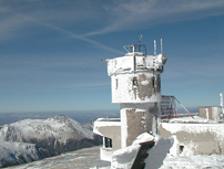
is located on the summit of Mt. Washington in the Sherman Adams building. The site is in the northeastern portion of the White Mountains above tree line at an elevation of 6,288 feet (44.27N, 71.30W). We would like to thank Mount Washington Observatory and the New Hampshire Department of Recreation and Economic Development for the use of their facilities to acquire the data provided here.
Data available... |
 |
| Pack Monadnock |
|
Pack Monadnock Observatory
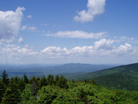
is located on the summit of Pack Monadnock in Miller State Park in Peterborough, NH (42° 51' 42.84" N, 71° 52' 43.27" W, elevation 2290 ft) in southwestern New Hampshire. There are several small buildings at the summit, along with a fire lookout tower, all surrounded by a mixed forest. All measurements were taken from air collected from above the canopy atop a 35 foot tower. We would like to thank the New Hampshire Department of Recreation and Economic Development for the use of their facilities to acquire the data provided here, and the New Hampshire Department of Environmental Services for their collaboration.
Data available...
|
 |
| Fort Constitution |
|
Fort Constitution
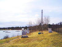
Fort Constitution Research Station Is located on New Castle Island at the mouth of the Piscataqua River (43.07 N, 70.71W, elevation 30 ft.) in New Castle NH. The site is bordered by the Gulf of Maine to the east and southeast, the Piscataqua River to the north and New Castle Island to the west and southwest.
Data available...
|
| |
| |
|