Fall 2012
watershed dynamics
IN A MEMORABLE SCENE from the movie "Amadeus," Emperor Joseph II tells an incredulous Wolfgang Amadeus Mozart that although the young composer's symphony he'd just premiered was indeed ingenious, it simply had "too many notes" to digest in one sitting.
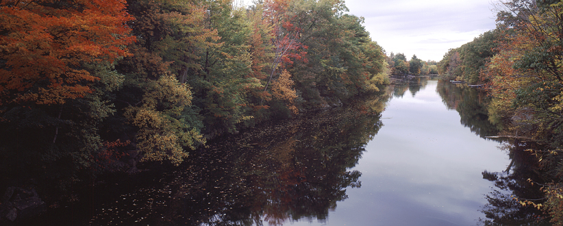 | |
| Lamprey River, New Hampshire Photo by Lisa Nugent, UNH Photo Services |
On the contrary, scientist Wil Wollheim is hoping a current NOAA/New Hampshire Sea Grant-funded project he's heading up will provide a rare cascade of "notes" to allow composition of what he calls an "aquatic symphony." Such a score would be rich in scientific detail and provide unprecedented insight into the chemical and physical processes of stream and river networks.
The symphony will be made possible by a suite of state-of-the-art underwater sensors Wollheim and colleagues are strategically deploying throughout the Lamprey River watershed that drains into coastal New Hampshire's Great Bay. Moreover, the same work will be broadened statewide through a separate National Science Foundation/NH Experimental Program to Stimulate Competitive Research (EPSCoR) program currently ramping up.
 |
|
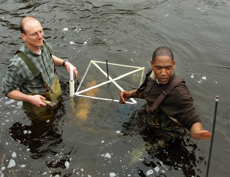
| Wil Wollheim and Richard Carey secure an aquatic sensor suite in the Lamprey River near Packer's Falls in Durham, N.H. Photo by Dick Lord. |
"Historically, what we've done is grab samples out of a river once per month or maybe once per week," notes Wollheim, an assistant professor in the EOS Earth Systems Research Center and UNH department of natural resources and environment (NREN). "And that's like trying to listen to a symphony by hearing only one note in every hundred. You have no idea what it really sounds like, it's just a few random tweets."
Now, with the miniaturized, high-tech sensor suites, a host of measurements will be made round-the-clock allowing the researchers to see things in great detail, including patterns that emerge through space and time. Sensors will be deployed over a two-year span on the main stem of the Lamprey River, and for several months at a time in selected tributaries.
Says Wollheim, "Through this we should be able to identify certain themes that occur and reoccur within a particular watershed. And, for example, if you have ten instruments working together making different measurements, now you can really begin to appreciate how the watershed works, begin to hear that symphony."
Also working on the project as co-investigators are professor William McDowell of NREN, scientists from the United States Geological Survey (USGS), research scientist Gopal Mulukutla, postdoctoral researcher Richard Carey, and graduate student Allison Price. The USGS is responsible for the deployment of aquatic sensors at one of the sites as well as housing the data on their website. The UNH Agricultural Experiment Station is also supporting this work.
Great, yes, but nitrogen "impaired"The NOAA/NH Sea Grant-funded project is looking primarily at the flux of nitrogen to Great Bay from the Lamprey River watershed in an effort to quantify and understand the patterns of this flux to the coastal zone, particularly during storm events.
 |
|
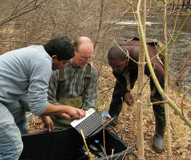
| Gopal Mulukutla, Wollheim, and Carey look at newly downloaded data from the Lamprey River deployment site near Packer's Falls. Photo by Dick Lord. |
The overarching objective of the research is to understand the mechanisms that control nitrogen exports over a range of climate and flow conditions so that local land use planners and decision makers can craft mitigation strategies for reducing locally generated nitrogen inputs to the watershed and, eventually, into Great Bay.
Great Bay is considered a "nitrogen impaired" water body due to elevated inputs from the surrounding watershed. Elevated nitrogen loads result from both point sources like wastewater treatment plants and non-point sources associated with intensified suburbanization as well as residual agricultural activity.
Nitrogen pollution causes algal blooms that consume oxygen and, in some cases, lower levels so severely that fish and shellfish die. Such algal blooms can also block sunlight to underwater grasses—like Great Bay's vital eelgrass beds—and prevent their growth.
A large proportion of non-point nitrogen export occurs during storm events due to enhanced mobilization and transport. But very little information exists regarding storm event nutrient dynamics because of the inherent logistical difficulties of collecting sufficient in situ samples throughout entire storm events and through the seasons.
Enter the new optical sensor technology and the Lamprey River project that will focus specifically on non-point sources of nitrogen. Each sensor suite will make ten critical measurements including nitrate (the compound created when nitrogen binds with water), phosphate, dissolved oxygen, etc. every half hour year-round. The multiple signatures will create a unique landuse/headwater "fingerprint" that can subsequently be identified downstream.
The work dovetails with the longer-term EPSCoR project to deploy water quality sensors at multiple stations on the Lamprey River, and several other sites throughout the state, over the next four years. To date, weekly sampling by McDowell's lab has shown that nitrate concentrations in the Lamprey increased substantially through 2009, but week-to-week variation was very high, ranging above and below the "safe" level of nitrogen for protecting Great Bay.
"This variation is really hard to understand with our current data set," says McDowell. "We need to know more about how quickly the levels go up and down, and whether that variation is related to season, extremes in stream flow, or variation in other chemical constituents. The sensors being deployed on the Lamprey will help untangle the drivers of this weekly variation in nitrogen levels."
Fingerprinting the watershed
To gauge the source of nitrogen input to the Lamprey watershed, ESRC/NREN master's student Price has been deploying the aquatic sensors in strategic headwater locations—forest, agricultural, and suburban. By making direct measurements in these waters well upstream of the mouth of the river, and during storm events in particular, the researchers will be able to discern how much nitrogen is coming from a specific land use type and compare these headwater readings with measurements taken lower down in the river's reach.
"We're hoping this comparison will show us which of the land uses explains most of the fingerprint or pattern we see at the watershed mouth as it enters Great Bay," says Wollheim. "And if there's a divergence, we hope to be able to explain that and figure out if there's some sort of process occurring that has mitigated the problem."
 |
|
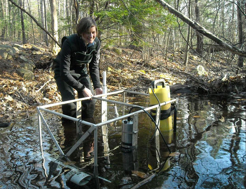
| Allison Price deploys the in situ sensor suite in a small, forested headwater stream at Saddleback Mountain in Northwood, N.H. where the Lamprey River originates. Photo by Richard Carey, UNH-EOS. |
In other words, if there's distinctly less nitrogen making its way to the mouth of the river, the river system itself must have effectively removed the nutrient, but how?
One possible answer could be the phenomenon of "spiraling" in which nitrogen is temporarily taken up by algae that eventually settle to the bottom and re-release the nitrogen to the water. Another, and permanent, method of nitrogen removal is denitrification—a process in which microbes turn nitrogen into the gaseous molecular form that makes up the bulk of our atmosphere. But the project aims to put a finer point on nitrogen removal by the river system.
Says Wollheim, "We want to understand the role of storms in controlling the flux of nitrogen to the coastal zone. Storms could be flushing nitrogen but we need to understand how storms interact with different land use types, different watersheds. We need to know how different storm types—length of time between storms, their intensity, et cetera—affect all this."
This latter part is the climate variability aspect of the project and ties into the projected changes the region will see as our climate shifts in the coming years and decades and brings higher temperatures, drought, and more intense precipitation events.
Improving the models
The work will also aid ongoing efforts within the EOS Water Systems Analysis Group, which Wollheim co-directs with ESRC research assistant professor Richard Lammers, to model these complex aquatic processes.
For example, getting high-resolution measurements directly at headwaters and downstream will provide clearly defined data that can be plugged into models and improve their ability to replicate the physical and chemical processes that occur.
"Once all these different sources have mixed together it becomes harder to sort out but with this new dataset we'll hopefully begin to model all this—how are different sources mixed together, where is it raining in the watershed compared to the different land uses, how far upstream is it, et cetera," says Wollheim. He adds, "And we're hoping through modeling we'll discern more about the ability of the aquatic system to cleanse itself of excessive nitrogen."
All of which will further the ultimate goal of mitigating nitrogen input into Great Bay and maintaining it as a healthy, functioning ecosystem for generations to come.
A video of the EPSCoR Lamprey River Water Study is available at the EPSCoR You Tube channel.